Use
The GIN platform combines data in a range of specialist areas (weather data, water levels, flow rates and wind and temperature data) on a single platform, allowing for a simpler and faster comprehensive analysis of the current situation.
GIN provides quick access to reliable data, which benefits natural hazard teams and the public in the following ways:
All data brought together on a single platform
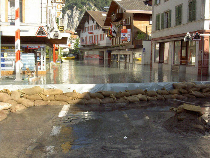
When assessing natural hazards, it is often crucial to consider a whole range of different aspects. In order to assess floods properly, for example, experts must take the following aspects into account: water level and flow measurements of rivers and lakes, weather trends, upcoming precipitation, and temperature fluctuations in the drainage basin (snowmelt). GIN provides quick and reliable access to all of this data in one centralised location.
Indirect network effect
The value of individual data increases when data is aggregated.
Broadening the horizons of cooperation
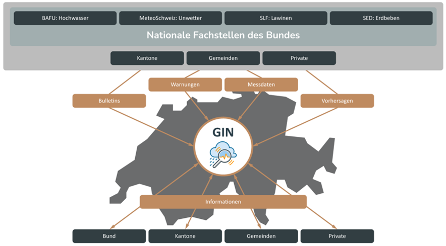
All natural hazard offices in the Confederation make their information available on the GIN platform. This makes GIN an internationally unique data-sharing project for public protection.
Preparing for emergencies
The GIN platform supports natural hazard experts in preparing for natural disasters. They can create, prepare and access their own data dossiers for all possible scenarios.
Personalised information
GIN users can tailor the platform to their requirements, allowing them to work more efficiently and quickly find the information they require during an actual emergency. The dossier function supports this by allowing users to combine and save views (maps, measurement tables, diagrams and forecasts) for later use. Users can also select which data should be displayed for individual measurement stations and set thresholds for every measurement value. They will then receive automatic notifications when a critical value has been exceeded.
Simplified cooperation work
Natural hazard experts work in a diverse network of specialists from many different organisations. GIN dossiers can be shared quickly and easily with other GIN users, which simplifies and improves cooperation among crisis teams.
Usability and data visualisation
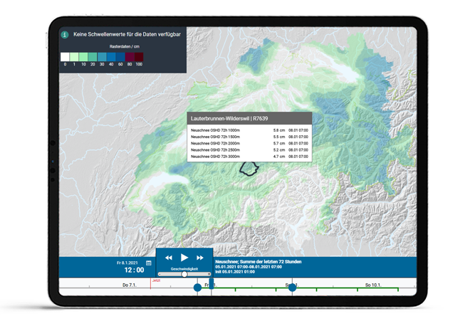
The comprehensive data collection is nevertheless easily accessible to its diverse group of users. Maps visualise the measurements to provide a quick overview. Interactive diagrams and tables are available for all parameters. Timeline navigation enables the animation of measurement and forecast data. The clear data visualisation can also be projected as a live image, e.g. into the command room of an operations centre in the event of a crisis.
Real-time data
GIN offers a high degree of availability and can visualise large amounts of data in real time.
Reliable availability through technology
GIN offers a high degree of availability. The platform operates using two redundant data centres. This means that even if one of them should fail, the platform would still work at an appropriate speed under an expected maximum load. The delivered data is processed on dedicated instances, which guarantees consistently high front-end performance.
- The internet of things at its best: almost live data from monitoring stations across Switzerland provided every 10 minutes;
- High availability (99.9%);
- Service times: 24/7;
- Good performance despite vast amounts of data (2.7 GB per day);
- Innovative end-to-end monitoring with bots that automatically monitor the flow of data at the monitoring stations;
- Developed and run on open-source software.
Multilingual
The GIN platform is available in five languages: German, French, Italian, Romansh and English.
Other relevant pages

Overview of the platform
The Joint Information Platform for Natural Hazards (GIN) combines all available data on natural hazards in Switzerland in a user-friendly map application. It provides a solid foundation for identifying natural hazards early and mastering them successfully.
Participants and data origin
The GIN project has facilitated close cooperation and data sharing among the federal offices, cantons and private companies. This is a unique form of cooperation.

API Interface
The GIN platform offers an API (application programming interface) which can be used to load data directly from the database to your own systems. Both measured and predicted data are available. You must log in to the GIN platform to use the API.

Legal framework
The Joint Information Platform for Natural Hazards (GIN) has its legal basis in Article 3 of the Ordinance of 11 November 2020 on Civil Protection (Civil Protection Ordinance; SR 520 12), which in turn is based on the Federal Act on Civil Protection and Civil Defence (SR 520.1).
Office GIN
Mühlestrasse 2
CH-3063 Ittigen